According to media reports, as of 10:00 AM on May 1st, there were a cumulative 76,000 mainland visitor arrivals in Hong Kong.
Meanwhile, at the recently viral High Island Reservoir East Dam and MacLehose Trail area, visitor flow had exceeded 1,000 people by 12:00 PM, reaching a "very busy" level.
The roads remained relatively empty, with the mountains, water, and dams forming the undisturbed main landscape.
This trail, once rated by National Geographic as one of the "world's best hiking trails," is undergoing an unprecedented transformation.
The MacLehose Trail has shifted from a "hiker's route" to a "tourist's photo spot."
Visual Illustration: Created based on holiday crowd scenarios at the High Island Reservoir East Dam and MacLehose Trail.
A Historical Microcosm of Hong Kong's Country Park System
When discussing Hong Kong's hiking culture, the MacLehose Trail is indispensable. Officially opened in 1979 and named after the 25th Governor of Hong Kong, Sir Murray MacLehose, this roughly 100-kilometer trail winds from Sai Kung in the east to Tuen Mun in the west. With its diverse scenery ranging from coastal landforms to high mountain landscapes, it was once rated by National Geographic as one of the world's best hiking trails.
The birth of the MacLehose Trail is inextricably linked to the establishment of Hong Kong's "Country Park" system. In the 1970s, facing rapid urban development, the British Hong Kong government recognized the urgent need to protect natural ecology and provide recreational spaces. The MacLehose Trail served as the connective tissue of this massive conservation project—unprecedentedly cutting across eight country parks, linking scattered natural areas into a complete ecological corridor.
However, positioning it as a "mass hiking trail" makes it easy to underestimate its true challenge. While it begins with the flat paved roads of the High Island Reservoir in Section 1, it is immediately followed by the continuous steep stone steps over Sai Wan Shan in Section 2, and the undulating, treacherous cliffs of Kai Kung Shan and Ma On Shan in Sections 3 and 4. These sections lack shade, feature massive elevation changes, and pose a severe test of physical stamina and willpower. By combining primitive mud paths, steep stairs, and forest roads, the trail showcases Hong Kong's geographical diversity while also placing high physical demands on climbers.
On April 19, 2026, reporters interviewed several tourists along the MacLehose Trail.
At the High Island Reservoir East Dam, most interviewed tourists cited similar sources for their visit: Xiaohongshu, Douyin, and friends' recommendations.
The majority mentioned that taking photos was the primary purpose of their trip. Most people on site were not wearing proper hiking gear.
However, when they actually stepped onto the mountain trail, their experience was not quite what they envisioned.
"It's much more exhausting than I thought."
"I didn't expect there to be no supply stations."
"I actually didn't prepare much."
Growing in tandem with social media popularity is the actual foot traffic on the ground.
AFCD data shows that visitor numbers around the High Island Reservoir East Dam surge significantly during holidays, making it one of the busiest country park entrances in Hong Kong.
As online "viral recommendations" continue to multiply, the physical trail is beginning to bear unprecedented pressure.
On social media, "MacLehose Trail" is often used as a general tag.
However, judging from the trend of topic popularity, "MacLehose Trail" and "MacLehose Trail Section 2" show a certain degree of similarity. This implies that when many tourists say they are "going to the MacLehose Trail," they are actually more likely referring to the Section 2 route connecting the High Island Reservoir East Dam, Po Pin Chau, and Long Ke Wan.
Data Interpretation: The topic popularity of "MacLehose Trail" and "MacLehose Trail Section 2" shows similar trends at multiple time points. This reflects that in the context of social media, what ordinary tourists call the "MacLehose Trail" largely points to the check-in route around Section 2. Data source: Douyin Creator Center Topic Popularity Index.
In many social media posts, bloggers package the MacLehose Trail as an ideal place to "escape the city bustle," rarely mentioning the route's actual difficulty and potential risks.
One of the most widely circulated "highlight routes" on social media is usually:
East Dam → Po Pin Chau → Return to East Dam → Long Ke Wan → Return to East Dam
According to multiple hiking guides and route data, this entire route is about 9 to 10 kilometers long with a cumulative elevation gain of 450 to 750 meters. If extended to include further parts of Section 2, the total journey can exceed 15 kilometers, taking roughly 6 to 10 hours. Although the Po Pin Chau side trail is short in distance (about 2 km round trip), the path features coastal rocky terrain, and some sections are close to cliffs, requiring about 1 to 2 hours.
Photos of the dirt paths along the Po Pin Chau section. Source: Provided by Xiaohongshu users.
Driven by the enthusiasm to capture the perfect photo and a misalignment with their own physical capabilities, many tourists end up paying the price with helicopter rescues.
December 31, 2025: A 21-year-old mainland university student fell from a cliff, prompting a helicopter rescue. Photo by Zhang Ziqi.
April 19, 2026: A man was airlifted to the hospital while hiking from the East Dam to Long Ke Wan. Witnesses stated he was a mainland tourist wearing Vans sneakers, suspected of suffering from heatstroke, and asked passing tourists for 'Huoxiang Zhengqi Water' (heatstroke medicine). Photo by Mo Junyu
Due to the mismatch between physical capabilities and the enthusiasm for checking in, helicopter rescues have become the price to pay.
In response to these situations, according to HK01, the AFCD has installed additional fencing at the Po Pin Chau viewing platform and utilized drones equipped with broadcasting capabilities to monitor the area from above during the May Day holiday, warning tourists not to cross the fences.
AFCD installed extra fencing at the Po Pin Chau viewing platform.
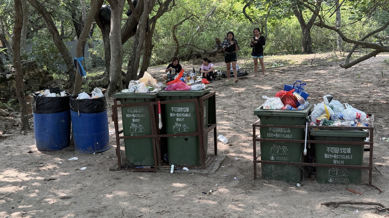
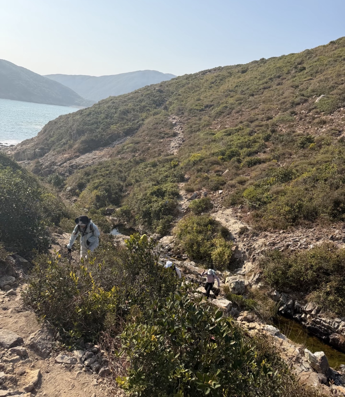
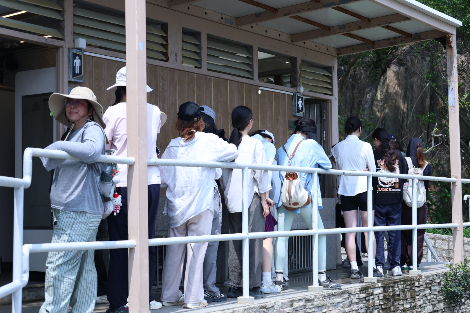
On April 19, 2026, when reporters visited the Long Ke Wan campsite, discarded food packaging was visible across the beach, with some featuring simplified Chinese characters. Ironically, a large trash bin was situated just a short distance from the litter. A mainland tourist who walked from Po Pin Chau to Long Ke Wan told reporters that the garbage situation around Po Pin Chau was even worse: "There is much more garbage up at Po Pin Chau than here."
Trash bin at the Long Ke Wan campsite. Photo by Yu Xiahan
Garbage scattered around the Long Ke Wan campsite. Photo by Yu Xiahan
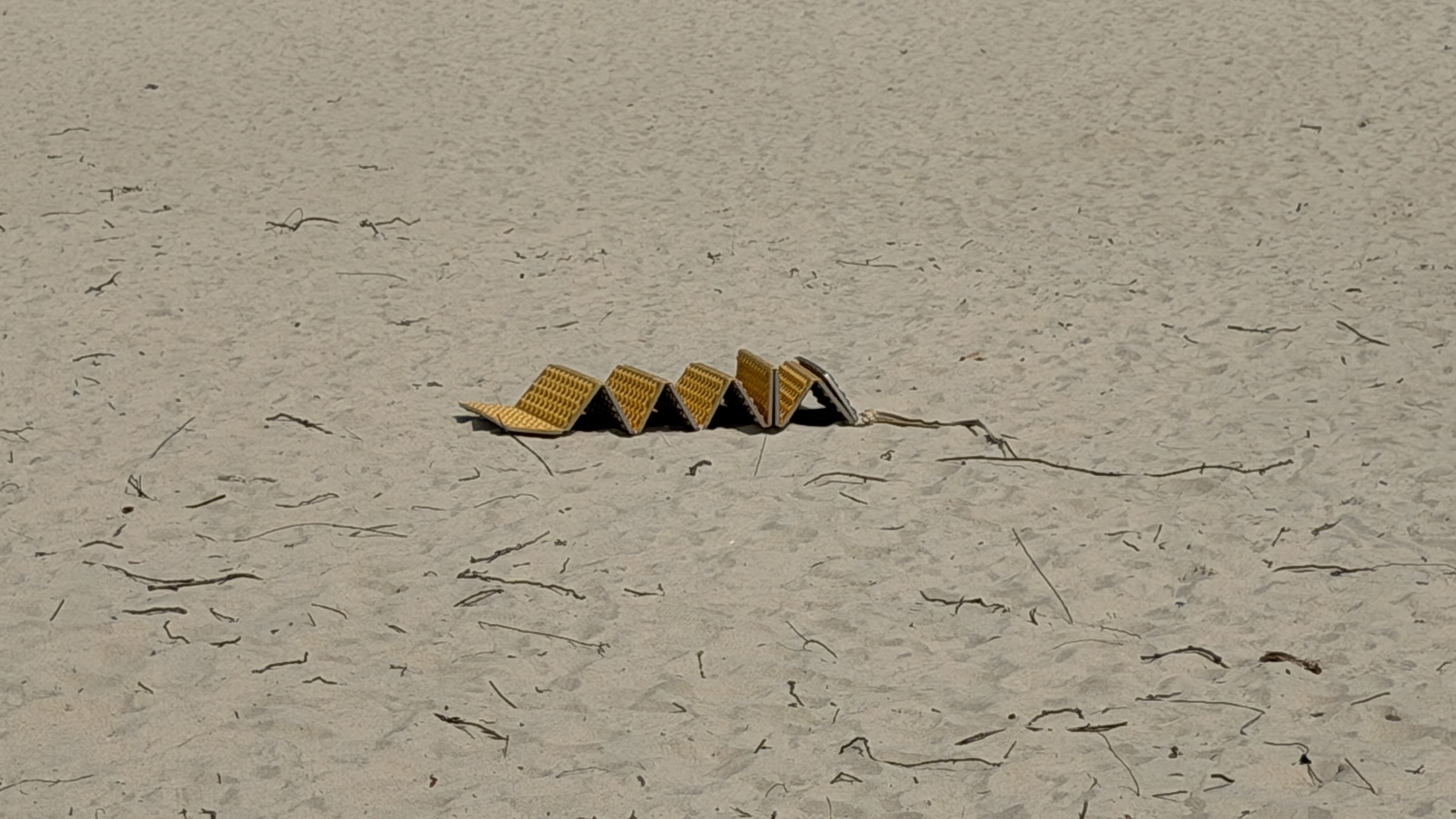
A discarded egg carton pad on the beach. Photo by Yu Xiahan
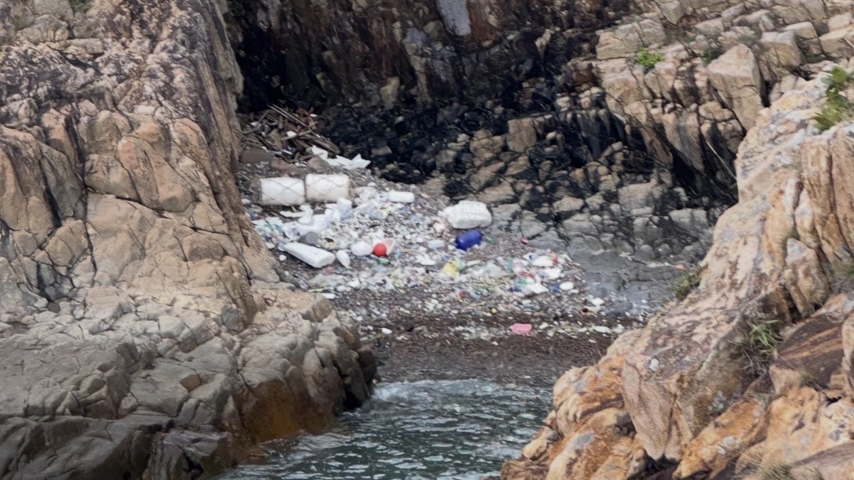
The garbage situation at the Po Pin Chau section. Photo by Yu Xiahan
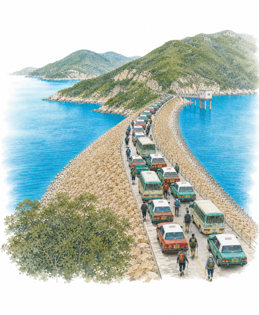
According to HK01, AFCD data revealed that over the 5-day Easter and Ching Ming Festival holidays, the department handled 18 enforcement cases involving littering and illegal camping at Sai Kung East Country Park (including the East Dam and popular campsites), and issued 418 verbal warnings. Multiple media outlets reported that AFCD volunteer teams, alongside businesses, initiated numerous cleanup operations, collecting waste ranging from disposable utensils and plastic bottles to leftover camping food scraps.
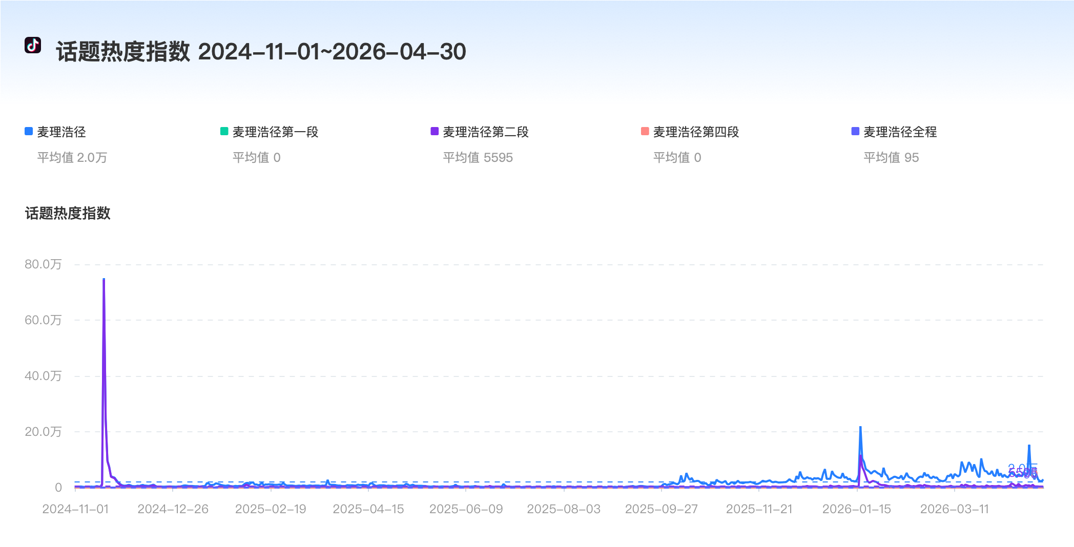
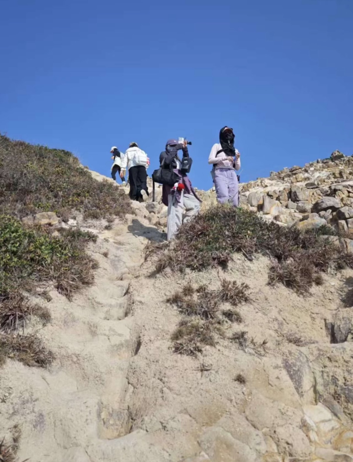
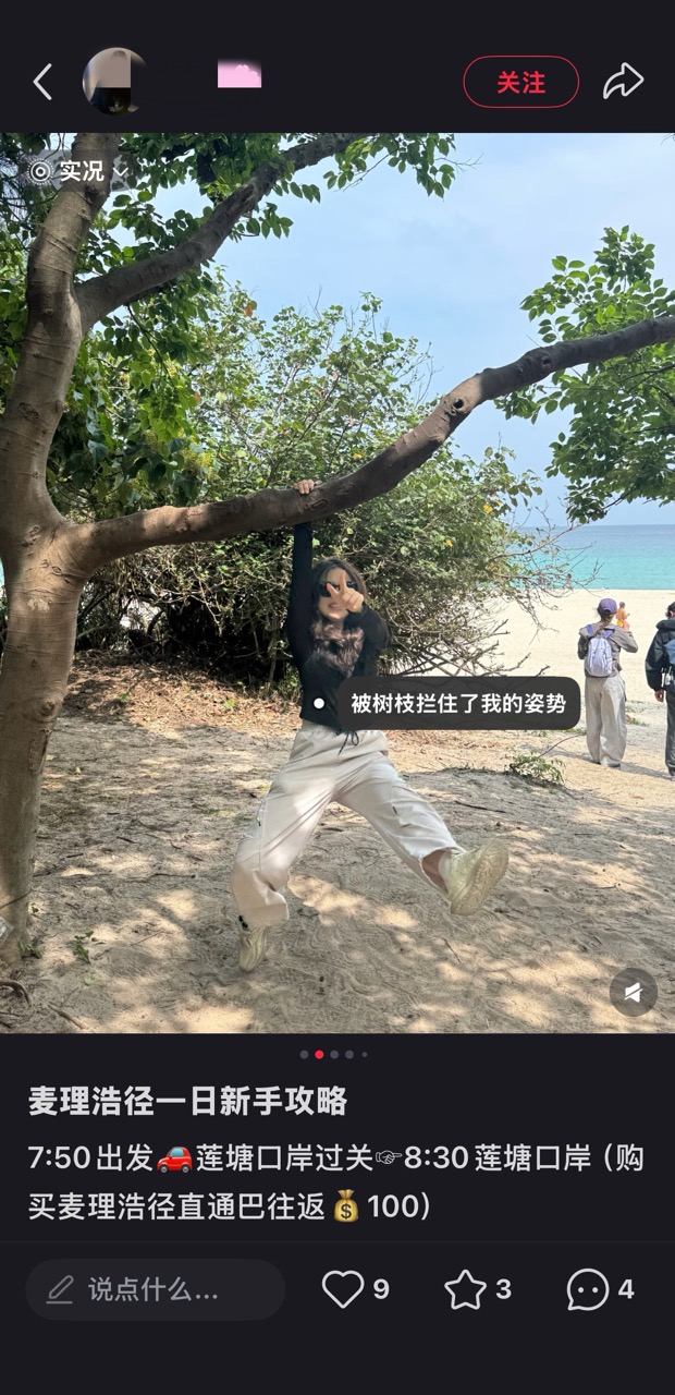
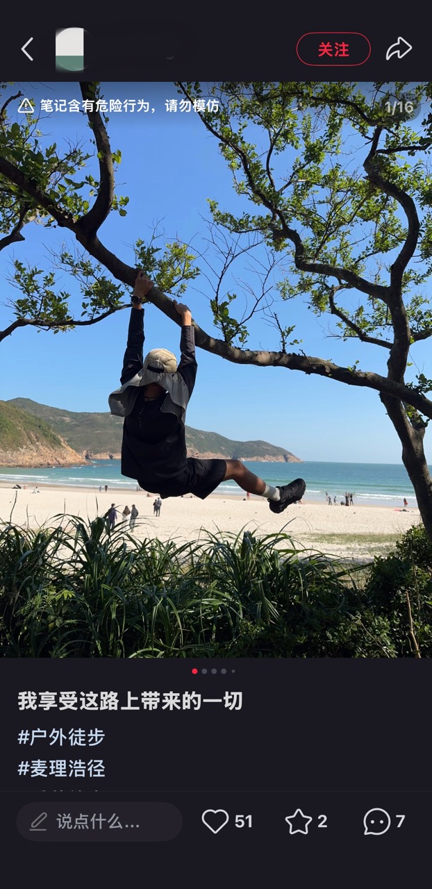
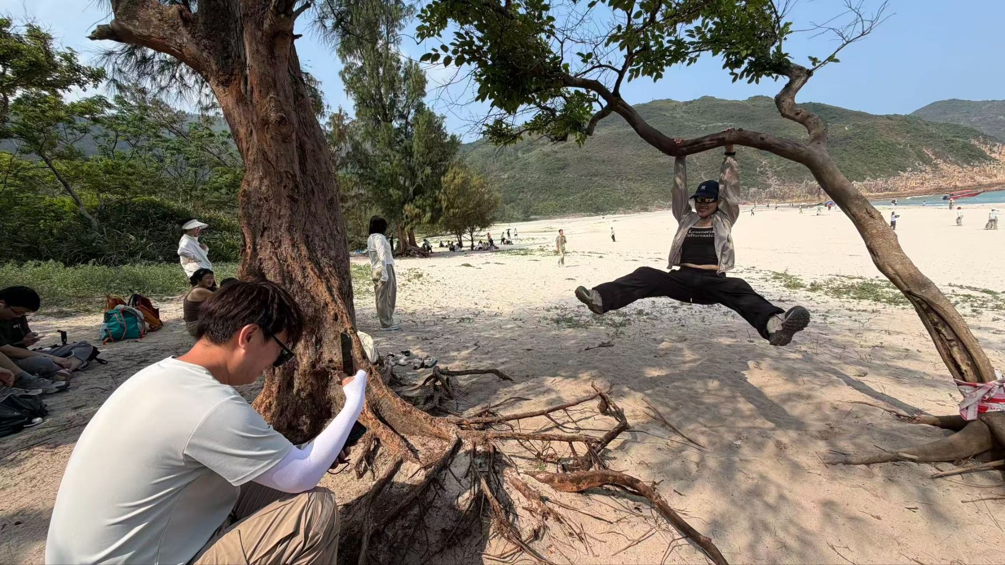
The impact of social media is altering tourist behaviors inside country parks. Recently, a "tree-hugging check-in" trend has emerged on Xiaohongshu. Numerous tourists climb trees along the MacLehose Trail for photos, sometimes imitating celebrity album covers (e.g., Eason Chan), and share them online tagging relevant topics.


Popular posts on Xiaohongshu regarding tree-hugging photos.
On April 19, 2026, reporters observed at the Long Ke Wan campsite that almost all "internet-famous trees" had long lines behind them. According to queuing tourists, it took about 10 minutes to get a turn for a photo.
Tourists lining up to take photos at the Long Ke Wan campsite. Photo by Yu Xiahan
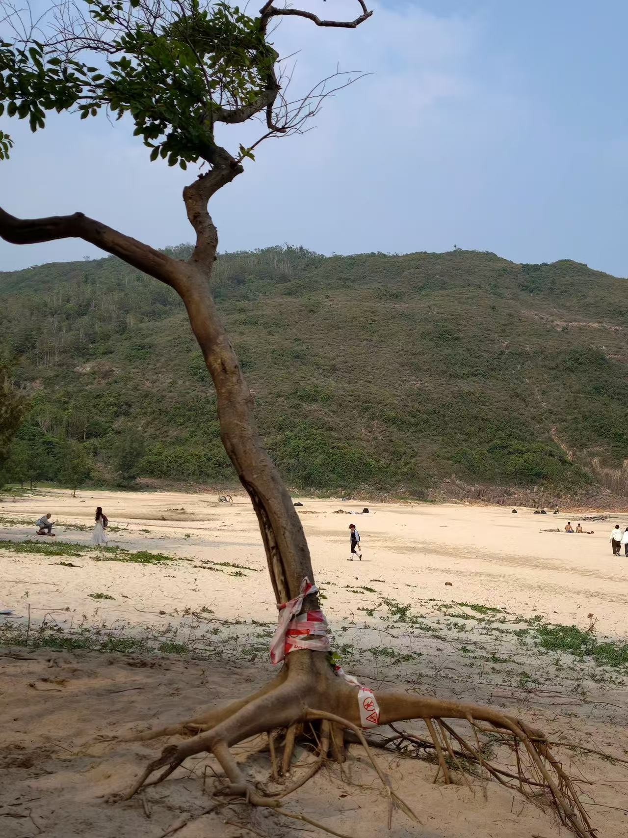
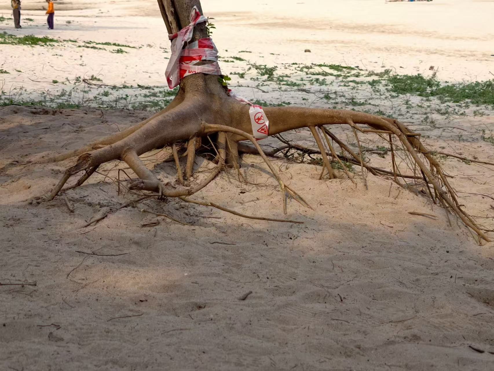
However, these behaviors have a direct negative impact on the natural environment. Because the trees cannot bear the repeated weight of human bodies, some branches have shown visible sagging or even structural damage. Despite authorities setting up danger warnings and barriers on site, tourists continue to ignore the warnings to climb.
Trees suffer damage due to the inability to bear repeated climbing weights.
Source: Provided by Xiaohongshu users
In response to reporters' inquiries, the AFCD stated that according to the Forests and Countryside Ordinance (Cap. 96), anyone who, without lawful authority or excuse, fells, cuts, burns, or otherwise destroys trees commits an offense and is liable on conviction to a maximum fine of HK$25,000 and one year in prison.
The AFCD also urged visitors not to climb trees to avoid accidents or causing damage to the trees. The department emphasized that, in response to the increasing number of visitors to the Sai Kung East Country Park, it will strengthen patrols, promotional education, and law enforcement work at popular spots (including the Long Ke Wan area) as needed.
As tourist numbers climb, the behavior of wildlife is quietly being altered. Wild boars traditionally relied on the natural environment to forage, but near crowded trails, garbage and artificial feeding have provided stable, high-energy food sources, causing them to gradually rely on humans.
The AFCD points out that frequent human contact causes wild boars to lose their innate fear of humans, leading them to actively approach or even snatch food, becoming much more aggressive. Supplemented by this extra food supply, the wild boar population may experience unnatural growth, further disrupting the ecological balance. As "wild animals" become accustomed to human presence, the once clear ecological boundaries begin to blur, and human-boar interactions shift from "accidental encounters" to "continuous contact or conflict."
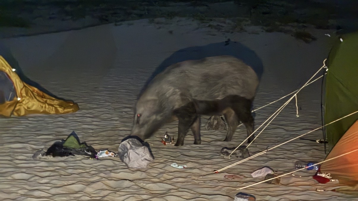
Encountering a wild boar on the MacLehose Trail. Source: Shared by Xiaohongshu users
With the soaring popularity of the MacLehose Trail, tourists' activities have extended from the mountain paths to the Sai Kung coastline, bringing the impact on marine ecology to the surface. Environmental groups have observed tourists stepping on corals and excavating marine life during water activities in popular spots like Sharp Island (Kiu Tsui Chau) and Tai Long Wan.
Corals are extremely fragile ecosystems that often take decades to grow, yet a single stomp can cause irreversible damage. When massive crowds repeatedly enter the same waters, this impact is drastically magnified. More importantly, corals are not just scenic attractions; they form the bedrock of marine ecology, and their degradation directly affects the habitats of fish and other marine organisms.
Section 2 currently has very few public restrooms, and using the women's restroom usually involves a lengthy wait.
Queueing situation at Section 2 on April 19. Photo by Yu Xiahan
The entirety of Section 2 spans roughly 13.5 kilometers, yet there is only 1 official water filling station located at Pak Tam Au.
According to AFCD data, Ham Tin Wan and Sai Wan are considered large campsites, with an officially suggested capacity of over 50 tent spaces each. Currently, apart from the Twisk Campsite which requires advance booking, all other designated campsites operate on a "first-come, first-served" basis. Therefore, the AFCD does not hold data on maximum tent numbers or overnight visitor limits for these sites.
Taking the second day of the Lunar New Year in 2026 as an example, there were an estimated 450 tents at Ham Tin Wan and 135 tents at Sai Wan. On May 1, 2026, the combined number of tents at Long Ke Wan, Sai Wan, and Ham Tin Wan campsites reached an estimated 1,100, far exceeding the site's capacity.
During holidays, the campsites are densely packed with tents.
Source: Shared by Xiaohongshu users
Scroll down to see how 400 extra tents fill the campsite
Measures and Effectiveness: The Sai Wan campsite, which became a disaster zone for litter and illegal camping last year, was targeted as a priority area by the AFCD during this year's May Day holiday. Reports indicated roughly 30 tents by the evening—a massive two-thirds drop from nearly 100 last year—with all of them pitched within designated zones.
Whenever AFCD officers spotted individuals pitching tents, they approached them to hand out informational cards and provide targeted education. They taught campers about campsite usage, stove fire safety, washing rules, and toilet etiquette, while reminding them to keep noise levels down and avoid damaging the natural environment. Large-scale cooking fires were strictly prohibited. The non-designated beach area near the Sai Wan store, which saw nearly 100 illegal tents forming a ridiculous "tent sea" last year, was heavily guarded by AFCD personnel this year. Anyone laying down ground mats or hammering tent pegs was immediately informed that the site was illegal and subject to prosecution or fines, successfully maintaining a "Zero Camping and Clean Beach" environment outside designated zones.
Every holiday, the East Dam of the High Island Reservoir is swarmed with taxis. Especially during the evening peak hours when tourists leave, wait times are extremely long. This immense transport demand places heavy pressure on the area:
Taxi Driver Mr. Hui:
"The peak demand is between 8:00 AM and 9:00 AM, with passengers primarily consisting of mainland tourists. Restricted by the narrow mountain roads, this period is frequently accompanied by severe traffic jams."
Route 9A Minibus Driver:
"We only operate on weekends and public holidays. Since last year, the crowds have exploded, especially on Saturdays. On busy days, we run about 13 trips per vehicle, almost completely full every time. We absolutely have to rely on AFCD staff on site to help guide the massive tourist queues, or else we couldn't maintain basic operations."
Stationed Police Officer:
"The traffic chaos is primarily concentrated on weekends and holidays. The police have to dispatch multiple vehicles to maintain order on-site, and our main task is preventing 'illegal cabs' (unlicensed drivers) from taking advantage of tourists by overcharging."
The challenges facing the MacLehose Trail are not isolated. Driven by social media, natural attractions around world have experienced similar transformations: trails originally meant for hikers or locals are flooded by massive crowds in a short time, putting severe pressure on public safety, environmental protection, and management resources. Mount Fuji serves as a notable reference case.
Large crowds of climbers queueing on the rocky slopes of Mount Fuji. GettyImages
Staff checking climbers' "climbing fee" wristbands. Xinhua/Getty Images
"Bullet climbing" refers to starting at night, hiking straight to the summit to see the sunrise, and descending immediately without resting overnight in a mountain hut. This method carries high risks, as climbers easily suffer from altitude sickness or hypothermia due to sleep deprivation and failure to acclimatize to the elevation.
The Yamanashi prefectural government installed a gate at the 5th Station of the Yoshida Trail, capping daily climbers at 4,000 (excluding those with hut reservations). Climbers must pay 2,000 yen (approx. 100 HKD) for a wristband to pass. Starting in 2025, the climbing fee will double to 4,000 yen, and the gate closing time will be brought forward.
Reports indicate the Shizuoka side achieved its first zero-fatality summer climbing season in three years. Furthermore, the region has long cultivated a "Leave No Trace" culture and widely installed eco-toilets to reduce environmental pollution.
A Yamanashi official noted, "Mount Fuji is screaming in pain," suggesting the construction of a light rail system to resolve traffic congestion. The Mayor of Fujinomiya is pushing for an "individual financial responsibility system for rescue operations" to serve as a substantial deterrent.
According to Legislative Council data, citywide prosecutions for littering in country parks in 2025 surged 3.4 times (to 42 cases), and illegal camping reached 116 cases, with Sai Kung East being the hardest hit.
During the May Day holiday, the AFCD utilized drones with broadcasting capabilities to monitor fence-crossing behaviors and used CCTV to surveil campsites. According to HK01, during the Easter and Ching Ming period, 418 verbal warnings were issued alongside 18 prosecutions.
The MacLehose Trail currently does not have a fixed visitor limit or a comprehensive reservation system. However, in response to reporters' inquiries, the AFCD stated that to effectively manage crowd flow at popular hiking spots, the department will reference past long-holiday experiences to review long-term management strategies for country parks and campsites, including exploring the introduction of reservation and fee systems.
The AFCD noted that such studies will consider various site conditions, encompassing ecological protection, visitor safety, access management, and practical operations. Details regarding reservation procedures, fee collection methods, real-name registration, enforcement arrangements, required facilities, and promotional plans are still under discussion.
At the same time, the AFCD announced that its "Hong Kong Country and Marine Parks" Xiaohongshu account is expected to launch mid-year. The content will introduce Hong Kong's natural scenery and hiking routes, while simultaneously promoting hiking safety, trail etiquette, and nature conservation. In other words, government departments are attempting to intervene in this flow of traffic on social media: not just letting the trails be seen, but hoping to ensure that the risks, rules, and conservation messages are seen as well.
A Trail Amplified by Algorithms
The rise in popularity on Douyin is equally striking. From March to April 28, 2026, the average daily heat index for the "MacLehose Trail" topic reached 51,000—a nearly 220-fold increase compared to the same period in 2023.
In response to reporters' inquiries regarding the relationship between social media popularity and foot traffic on the MacLehose Trail, the Agriculture, Fisheries and Conservation Department (AFCD) stated: "We have noticed that discussions about Hong Kong hiking routes on social media have continued to increase in recent years, with the MacLehose Trail being one of the most highly anticipated routes."
The AFCD also noted that they closely "monitor social media dynamics" to serve as a reference for "assessing crowd flow trends, identifying potential risks, and deploying resources." They also plan to launch an official Xiaohongshu account by mid-year to introduce Hong Kong's natural scenery and outing routes, while publishing content on hiking safety, trail etiquette, and nature conservation.